
LabPA-CM.
Criteria, methods and contemporary techniques for landscape knowledge and its conservartion


Description
This program of research activities addresses theoretical, methodological and applied problems in order to contribute to the knowledge and preservation of landscapes. It addresses the two sspatial levels agreed upon by the National Cultural Landscape Plan: (i) Landscapes of special cultural interest, of exceptional value and suitable to become protected properties. (ii) Everyday landscapes, defined by the European Landscape Convention as “those that correspond to most of the environments where people live, are constantly changing as a result of social, economic and environmental development, and are valued by the population on the basis of individual and social well-being”.

Team
The consortium is formed by the groups:
GIPC
Grupo de Investigación Paisaje Cultural (coordinador)
Universidad Politécnica de Madrid
GESYP
Geovisualización, Espacios Singulares y Patrimonio
Universidad Politécnica de Madrid
ADAPTA
Sistemas Socio-ecológicos, Paisaje y Desarrollo Local
Universidad Complutense de Madrid
.
Supported by the following partner groups:
ASSOCIATED GROUPS
+Centro Interuniversitario di Ricerca Biodiversità, Fitosociologia ed Ecologia del Paesaggio (CIRBFEP).
La Sapienza University of Rome.
Escuela de Altos Estudios Hispánicos e Ibéricos (EHEHI)
Casa de Velázquez.
EUROPARC-España
Fundación Interuniversitaria Fernando González Bernáldez.
Comisión Técnica de Seguimiento del Plan Nacional de Paisaje Cultural
Subdirección General del Instituto de Patrimonio Cultural de España (IPCE).
Aims
01. Apply geomatics techniques for digital documentation of landscapes.
02. Implement techniques for transdisciplinary landscape research.
03. Develop new methods of historical interpretation of the landscape through its representations.
04. To characterize the landscape heritage of Madrid.
05. Obtain conservation guidelines for different types of landscapes.
06. To face problems of the relationship between rural landscape, territorial development, tourism and leisure.
07. Promote internationalization, training and dissemination actions.
Results
Journal articles
+Graziella Trovato. “Postproduction in the Research on the Urban Cultural Landscape: From the Transfer of Results to the Exchange of Knowledge on Digital Platforms and Social Networks—The TRAHERE Project in Madrid” Land vol. 12, no. 1 (2023): 31.
Alicia López-Rodríguez y Verónica Hernández-Jiménez. “Sustainable Forest, Beautiful Forest, Well-Managed Forest: Attitudes towards Land Management and Their Influence on the Perception of a Mediterranean Agroforestry Landscape” Land vol. 11, no. 8 (2022): 1260.
Javier Raimundo, Serafin Lopez-Cuervo Medina, Julian Aguirre de Mata y Juan F. Prieto, “Multisensor Data Fusion by Means of Voxelization: Application to a Construction Element of Historic Heritage,” Remote Sensing vol. 14, no. 17 (2022): 4172.
Nicolás Marine, Cecilia Arnaiz-Schmitz, Luis Santos-Cid y María Fe Schmitz “Can We Foresee Landscape Interest? Maximum Entropy Applied to Social Media Photographs: A Case Study in Madrid,” Land vol. 11, no. 5 (2022): 715.
María Fe Schmitz, Cecilia Arnáiz-Schmitz y Francisco Díaz Pineda, “Paisajes de la trashumancia y turismo de naturaleza. Una oportunidad para la conservación y el desarrollo sostenible,” Ambienta: Revista del Ministerio de Medio Ambiente, no. 132 (2022): 46-51.
Nicolas Marine “Landscape Assessment Methods Derived from the European Landscape Convention: Comparison of Three Spanish Cases,” Earth vol. 3, no. 2 (2022): 522-536.
Miguel Á. Maté-González, Jesús Rodríguez-Hernández, Cristina Sáez Blázquez, Libertad Troitiño Torralba, Luis J. Sánchez-Aparicio, Jesús Fernández Hernández, Tomás R. Herrero Tejedor, José F. Fabián García, Marco Piras, Carlos Díaz-Sánchez, Diego González-Aguilera, Gonzalo Ruiz Zapatero y Jesús R. Álvarez-Sanchís “Challenges and Possibilities of Archaeological Sites Virtual Tours: The Ulaca Oppidum (Central Spain) as a Case Study” Remote Sensing vol. 14, no. 3 (2022): 524.
Cecilia Arnaiz Schmitz, José María Rey-Matesanz, Cristina Herrero-Jáuregui, Francisco Arques Soler y María Fe Schmitz “Impacto socio-ecológico de la COVID-19 en el medio rural. Un caso de estudio en el centro de España“, Barataria. Revista Castellano-Manchega de Ciencias Sociales, no. 30 (2021)
Enrique Pérez-Martín, Serafín López-Cuervo Medina, Tomás Herrero-Tejedor, Miguel Pérez-Souza, Julian Aguirre de Mata y Alejandra Ezquerra-Canalejo “Assessment of Tree Diameter Estimation Methods from Mobile Laser Scanning in a Historic Garden,” Forests vol. 12, no. 8 (2021): 1013.
María Fe Schmitz y Cristina Herrero-Jáuregui “Cultural Landscape Preservation and Social–Ecological Sustainability“, Sustainability vol. 13, no. 5 (2021): 2593.
Javier Raimundo, Serafín Lopez-Cuervo Medina, Juan F. Prieto, y Julian Aguirre de Mata “Super Resolution Infrared Thermal Imaging Using Pansharpening Algorithms: Quantitative Assessment and Application to UAV Thermal Imaging,” Sensors vol. 21, no. 4 (2021): 1265.
María Fe Schmitz, Cecilia Arnaiz-Schmitz y Patricio Sarmiento-Mateos “High Nature Value Farming Systems and Protected Areas: Conservation Opportunities or Land Abandonment? A Study Case in the Madrid Region (Spain)“, Land vol. 10, no. 7 (2021): 721.
Cecilia Arnaiz-Schmitz, Cristina Herrero-Jáuregui y María Fe Schmitz “Recreational and Nature-Based Tourism as a Cultural Ecosystem Service. Assessment and Mapping in a Rural-Urban Gradient of Central Spain“, Land vol. 10, no. 4 (2021): 343.
Declia M. Andries, Cecilia Arnaiz-Schmitz, Pablo Díaz-Rodríguez, Cristina Herrero-Jáuregui y María Fe Schmitz “Sustainable Tourism and Natural Protected Areas: Exploring Local Population Perceptions in a Post-Conflict Scenario“, Land vol. 10, no. 3 (2021): 331.
David Escudero y Manuel Rodrigo de la O Cabrera “Experiencias patrimoniales: entre arquitectura de paisaje y obra pública”, RdM: Revista de Museología, no. 81 (2021): 82-94.
Pedro Molina-Holgado, Nieves López-Estébanez, Ana Belén Berrocal-Menárguez, Fernando Allende-Álvarez, Miguel del Corro-Toro “The Contribution of Local Management to Biodiversity Conservation: An Analysis of Specific Cases in the Region of Madrid (Spain)“, Land vol. 9, no. 11 (2020): 462.
Nicolás Marine, Cecilia Arnaiz-Schmitz, Cristina Herrero-Jáuregui, Manuel Rodrigo de la O Cabrera, David Escudero, Maria Fe Schmitz “Protected Landscapes in Spain: Reasons for Protection and Sustainability of Conservation Management“, Sustainability vol. 12, no. 17 (2020): 6913.
Manuel Rodrigo de la O Cabrera, Nicolás Marine y David Escudero “Spatialities of cultural landscapes: towards a unified vision of Spanish practices within the European Landscape Convention“, European Planning Studies vol. 28, no. 9 (2020): 1877-1898.
Nicolás Mariné “Del Fresh Pond al Mystic River: topografía y horizonte en el paisajismo de los Olmsted“, Proyecto Progreso Arquitectura, no. 23 (2020): 160-177.
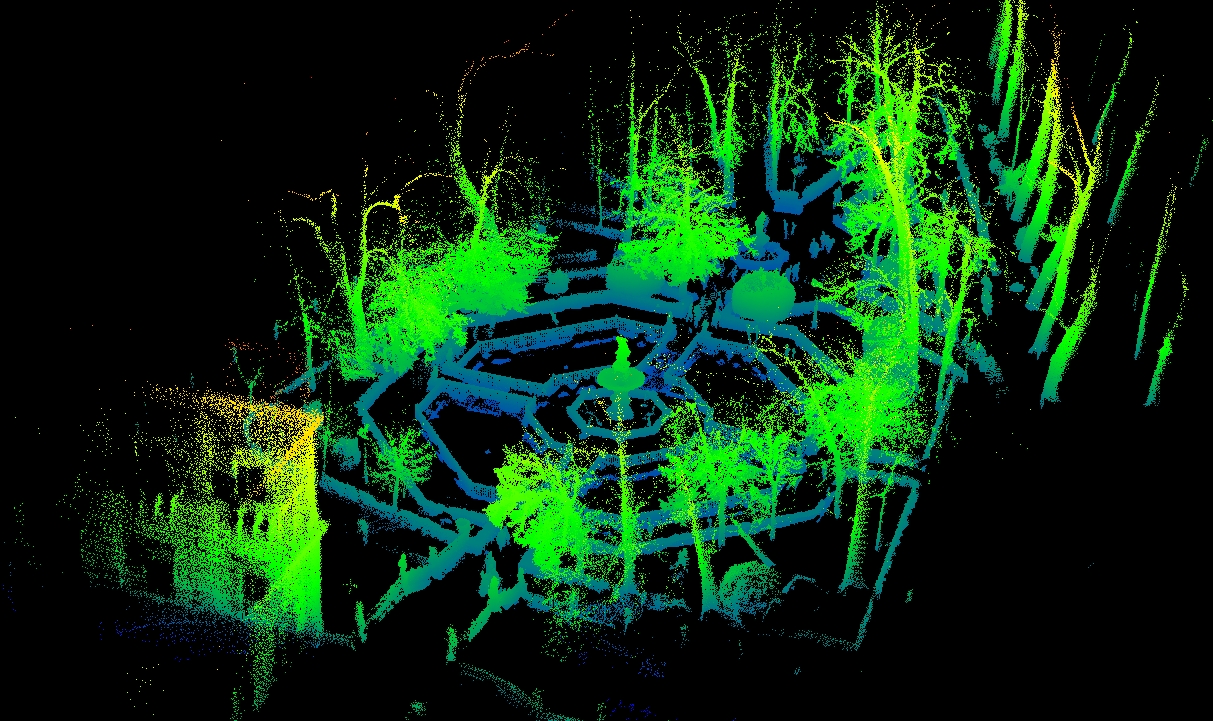
Tomás Herrero-Tejedor, Francisco Arques Soler, Serafín López-Cuervo Medina, Manuel Rodrigo de la O Cabrera, Juan Luis Martín Romero “Documenting a cultural landscape using point-cloud 3d models obtained with geomatic integration techniques. The case of the El Encín atomic garden, Madrid (Spain),” PLoS ONE vol. 15, n0. 6 (2020): e0235169.
Pedro Molina Holgado, L. Jendrzyczkowski Rieth, Ana Belén Berrocal Menárguez, F. Allende Álvarez “The Analysis of Urban Fluvial Landscapes in the Centre of Spain: Their Characterization, Values and Interventions“, Sustainability vol. 12, no. 11 (2020): 4661.
Manuel Rodrigo de la O Cabrera “Conservación viva o el momento de la arquitectura de paisaje”, Patrimonio Cultural de España, no. 12 (2020): 177-187.
Ana Belén Berrocal y Pedro Molina Hidalgo “Los retos paisajísticos en el diseño y construcción de obras”, Patrimonio Cultural de España, no. 12 (2020): 189-204.
María A. Leboreiro Amaro “Trabajar los límites”, Patrimonio Cultural de España, no. 12 (2020): 269-282.
Patricio Sarmiento-Mateos, Cecilia Arnáiz-Schmitz, Cristina Herrero-Jáuregui, Francisco D. Pineda y María F. Schmitz “¿Conflictiva relación entre Espacio Natural Protegido y Paisaje Rural Cultural?”, Patrimonio Cultural de España, no. 12 (2020): 189-204.
David Escudero “¿El paisaje del cine o el cine del paisaje? Una nueva significación cultural en el Desierto de Tabernas”, Patrimonio Cultural de España, no. 12 (2020): 333-346.
Francisco Arques y Nicolás Mariné “Hacia un hiperatlas para el conocimiento y difusión de los paisajes culturales españoles”, Patrimonio Cultural de España, no. 12 (2020): 373-384.
Tomás Herrero Tejedor “Tecnologías geoespaciales aplicadas a la documentación de paisajes culturales”, Patrimonio Cultural de España, no. 12 (2020): 385-399.
Graziella Trovato y Luis Moya “Madrid Nuevo Norte. Masterplan di Rogers Stirk Harbour”. Io ARCH, no. 86 (2020): 4041.
Diego Martín Sánchez y Noemí Gómez Lobo “Urban Forest Tweeting: Social Media as More-Than-Human Communication in Tokyo’s Rinshinomori Park”, Land vol. 12, no. 4 (2023): 727.
Books
+Graziella Trovato, Madrid, entre río y raíles. Pasado, presente y futuro del Pasillo Verde Ferroviario. (Madrid: Ediciones Lampreave, 2022).
Francisco Arques y Concha Lapayese, Territorios de Investigación (Madrid: Ediciones Asimétricas, 2021).
María Fe Schmitz y Cristina Herrero-Jáuregui (eds.) Cultural Landscapes: Preservation and Social–Ecological Sustainability (Basilea: MDPI, 2021).
Carmen Toribio Marín y A. Duarte Rodrigues (eds.), The History of Water Management in the Iberian Peninsula. Between the 16th and the 19th Centuries (Berlín: Springer, Birkhäuser, 2020).
Book chapters
+Francisco Arques Soler, “51º 30′ 46.20” N, 7º 1′ 08.85” E”, en Arquitectura y paisaje: transferencias históricas, retos contemporáneos vol. II, coord. por David Arredondo Garrido et al. (Madrid: Abada, 2022), 1311-1322.
Isabel Rodríguez de la Rosa, “‘El maridaje de lo bello con lo útil’: el paisaje en la cuenca del Noguera ribagorzana, 1946-1962”, en Arquitectura y paisaje: transferencias históricas, retos contemporáneos vol. II, coord. por David Arredondo Garrido et al. (Madrid: Abada, 2022), 1661-1672.
Carmen Toribio Marín, Rosana Rubio Hernando y Rafael García García “Paisaje Collage. La integración de las quintas de recreo del camino de Aragón en la ciudad del siglo XXI”, en Arquitectura y paisaje: transferencias históricas, retos contemporáneos, coord. por David Arredondo Garrido et al. (Madrid: Abada, 2021), 587-600.
Manuel Rodrigo de la O Cabrera ‘Dentro del paisaje: salidas de campo’, en Francisco Arques y Concha Lapayese (eds.), Territorios de Investigación (Madrid: Ediciones Asimétricas, 2021), 320-323.
Carmen Toribio Marín, ‘Dams in the Renaissance Gardens of the Iberian Peninsula’, en Toribio Marín y A. Duarte Rodrigues (eds.) The History of Water Management in the Iberian Peninsula. Between the 16th and the 19th Centuries (Berlín: Springer, Birkhäuser, 2020), 159-177.
Tomás Herrero-Tejedor, Francisco Arques Soler, Serafín López Cuervo, José Luis Martín Romero y Oscar García Uriarte “Técnicas geomáticas aplicadas al paisaje cultural”, en M. Bueso Manzanas, C. Aguado Serrano & A. Guerrero García (coords.) La ciencia y el Arte VII: Ciencias y tecnologías aplicadas a la conservación del patrimonio (Madrid: Ministerio de Cultura y Deporte, 2020), 597-602.
Francisco Arques ‘Morphogénèse Architecturale. Le Centre d’études hydrographiques de Madrid, Miguel Fisac architecte’, en F. Graf, Y. Delemontey (eds.), Histoire et sauvegarde de l’architecture industrialisée et préfabriquée au XX siègle (Lausana: EPFL Press, 2020).
Nicolás Mariné, “De la escena al mapa: la noción de lo geo-escópico en la relación entre la ingeniería y el paisajismo“, en M.A. Álvarez Areces (coord.), Patrimonio de la industrialización. Geografías, geometrías y empleos (Gijón: CICEES, 2020), 653-666.
Manuel Rodrigo de la O Cabrera, Nicolás Mariné y Isabel Rodríguez de la Rosa, “The Stand for Madrid: estudio de apreciación social para el paisaje cultural de la batalla del Jarama“, en M.A. Álvarez Areces (coord.), Patrimonio de la industrialización. Geografías, geometrías y empleos (Gijón: CICEES, 2020), 477-486.
Ana Belén Berrocal, “La dimensión paisajística de la obra pública. Geometrías y geografías de su paisaje“, en M.A. Álvarez Areces (coord.), Patrimonio de la industrialización. Geografías, geometrías y empleos (Gijón: CICEES, 2020), 31-38.
Manuel Rodrigo de la O Cabrera, David Escudero y Isabel Rodríguez de la Rosa, “Los paisajes históricos de la sal: un análisis espacial“, en M.A. Álvarez Areces, Patrimonio de la industrialización. Geografías, geometrías y empleos (Gijón: CICEES, 2020), 685-696.
Francisco Díaz Pineda, “Enfoque ecosistémico. Servicios de los ecosistemas terrestres”, en L. Jiménez Herrero & E. Pérez Lagüela (eds.), Uso sostenible del patrimonio natural. Serie Sostenibilidad y Patrimonio Natural, n0. 25 (Madrid: Fundación Banco Santander, 2020), 42-57.
Miguel Ángel Aníbaro Rodríguez “Los pueblos de la Mancomunidad de Hornuez. Un diagnóstico de paisaje”. En Paisaje y patrimonio en el nordeste de Segovia. La Mancomunidad de Nuestra Señora de Hornuez (Madrid: Fundación Diego de Sagredo, 2020), 239-263.
María A. Leboreiro Amaro, D. E. Leboreiro Arias “La marca “pueblos mágicos” como nueva tipologia de turismo rural”. En Transversal Tourism and Landscape (Barcelona: UPCommons, 2020), 361-380.
Enrique Pérez Martín, S. López-Cuervo Medina, Julián Aguirre De Mata, Tomás Ramón Herrero Tejedor, Carmen Toribio Marín, Juan F. Prieto Morín, Nicolás Mariné Carretero, A. Ezquerra Canalejo, David Escudero Boyero, Miguel Ángel Maté González. En M. M. Simón Márquez, J. J. Gázquez Linares, A. B. Barragán Martín, A. Martos Martínez (comp.), Innovación Docente e Investigación en Ciencias, Ingeniería y Arquitectura: Experiencias de cambio en la Metodología Docente (Madrid: Dykinson, 2022), 487-500.
Papers and presentations at conferences
+David Escudero, Diego Martín Sánchez, Nicolás Mariné y Rodrigo de la O, “A Filmic Mapping of Madrid: The Urban Environment as a Qualitative Cloud for Digital Art History”, en IV International Conference on Digital Art History: Methods, Practices, Epistemologies. Zagreb, del 3 al 4 de octubre de 2022.
Rodrigo de la O, Francisco Arques, David Escudero y Nicolás Mariné, “Heritage Practices and Contemporary Landscapes: Reflections after 20 years of the European Landscape Convention”, en ECLAS Conference 2022: Scales of Change (Ljubljana: University of Ljubljana, 2022), 37.
Nicolás Marine, Cecilia Arnaiz-Schmitz. ‘Heritage Landscapes in the Age of Social Media’. 27th Conference on Cultural Heritage and New Technologies. Vienna, 10-12 Noviembre 2022.
Graziella Trovato.‘Social media platforms and knowledge exchange. TRAHERE project as an instrument for the transmission of heritage culture’. 27th Conference on Cultural Heritage and New Technologies. Vienna, 10-12 Noviembre 2022.
Francisco Arques, Rodrigo de la O. Comité científico del XII Congreso Internacional AR&PA 2022: Repensar el patrimonio cultural en un mundo digital y en crisis. 10-12 de Noviembre 2022
Graziella Trovato. “Madrid, entre río y raíles”, principales resultados del proyecto TRAHERE TRAin HEritage REus. XXIV Jornadas Internacionales de Patrimonio Industrial INCUNA: Sitios Industriales y Obra Pública. De lo local a lo universal. Gijón, del 28 septiembre al 1 octubre 2022.
David Escudero, Laura Martínez. “Desafíos patrimoniales en torno a la industria hidroeléctrica de Enguídanos (Cuenca)”. XXIV Jornadas Internacionales de Patrimonio Industrial INCUNA: Sitios Industriales y Obra Pública. De lo local a lo universal. Gijón, del 28 septiembre al 1 octubre 2022.
Eduardo de Nó, Diego Toribio, Rodrigo de la O. “Otros futuros: Paisaje, patrimonio y socio-ecología en la Región Metropolitana de Madrid”. XXIV Jornadas Internacionales de Patrimonio Industrial INCUNA: Sitios Industriales y Obra Pública. De lo local a lo universal. Gijón, del 28 septiembre al 1 octubre 2022.
Alicia López-Rodriguez, Ana Belén Berrocal Menárguez y Clara Zamorano Martín. “Do You Really Know What You Are Seeing in that Landscape? A Technological Tool to Learn How to Interpret the European Cultural Landscapes by Train”. 14th annual International Conference of Education, Research and Innovation. 8-9 November, 2021.
Ana Belén Berrocal Menárguez, Alicia López-Rodriguez y Clara Zamorano Martín. “RailToLand, a Collective Ideation Platform to Develop Innovative Tools to Communicate the European Cultural Landscapes by Train”. 14th annual International Conference of Education, Research and Innovation. 8-9 November, 2021.
Cristina Herrero-Jáuregui, Cecilia Arnaiz-Schmitz, María Fe Schmitz, Antonio Alberto Rodríguez Sousa, Belén Acosta, Elena Daniela Concepción, Marta Ortega, Alejandro Rescia. ‘Effects of the COVID pandemic on the dynamics and structure of socialecological systems along urban rural gradients in Madrid (Spain)’. V Congreso Ibérico de Ecología del paisaje: Changing landscapes and Society. 18-19 de noviembre de 2021.
Luis Moya y Graziella Trovato. ‘El paisaje de Madrid, entre río y railes. El futuro del Pasillo Verde Ferroviario, treinta años después de su realización’. I Congreso Internacional de Paisajistas de la Asociación Española de Paisajistas (AEP). 20-22 de octubre de 2021.
David Escudero, Rodrigo de la O y Nicolás Mariné. “Landscape as cultural property: emarcation issues”. En LAC2020+1 Landscape Archaeology Conference. Madrid, 08-11 june 2021. Organizado por el Consejo Superior de Investigaciones Científicas (CSIC), 2021.
Serafín López-Cuervo Medina, Tomás Herrero-Tejedor, Francisco Arques Soler, Juan López de Herrera, Juan Francisco Prieto Morin. ‘Documenting the Jardín de la Isla in Aranjuez cultural landscape using geospatial techniques”. En LAC2020+1 Landscape Archaeology Conference. Madrid, 08-11 june 2021. Organizado por el Consejo Superior de Investigaciones Científicas (CSIC), 2021.
Isabel Rodríguez de la Rosa. ‘Building the Spanish Landscape: New Approaches into Autarkic Industrialization’. III ESACH Meeting: ‘Our common past, our future’. Madrid, 07-09/06/2021. Organizado por European Students’ Association for Cultural Heritage.
Serafín López-Cuervo Medina y Juan Francisco Prieto Morin. “Aumento de Resolución de Imágenes Térmicas procedentes de UAVs mediane algoritmos de pansharpening”. III Congreso en Ingeniería Geomática CIGEO 2021. Valencia, 7-8 de julio 2021.
Serafín López-Cuervo Medina y Juan Francisco Prieto Morin. “Resolution enhancement of infrared thermal imaging by pansharpening algorithms.’ CIPA 2021: 28th Conference of the International Committee for Documentation of Cultural Heritage. Beijing, 28 agosto-1 septiembre 2021.
Cecilia Arnaiz, María Fe Schmitz, Francisco Arques, Rodrigo de la O. ‘Designing green systems for climate change mitigation: Madrid case study’. Ecocity World Summit 2021. Rotterdam, 27-30 septiembre 2021.
Nicolás Mariné, Francisco Arques, David Escudero, Rodrigo de la O. ‘Red de Investigación en Paisajes Culturales: reflexiones contemporáneas tras 20 años del Convenio Europeo del Paisaje’. XXII Jornadas INCUNA: ‘Hacia un New Deal para el Patrimonio Industrial’. Gijón, 23-26/09/2020. Incuna – Patrimonio de la Industria, Cultura y Naturaleza
Isabel Rodríguez de la Rosa. ‘Patrimonio industrial y paisajes culturales: conexiones antropogénicas’. XXII Jornadas INCUNA: ‘Hacia un New Deal para el Patrimonio Industrial’. Gijón, 23-26/09/2020. Organiza Incuna – Patrimonio de la Industria, Cultura y Naturaleza.
Concepción Lapayese. ‘La construcción del paisaje cultural’. IV Urban Regeneration Forum. Territorios 2030: Espacios para la movilidad. 10-11/12/2020. Bilbao Bizkaia Architecture.
Workshops, seminars and forums
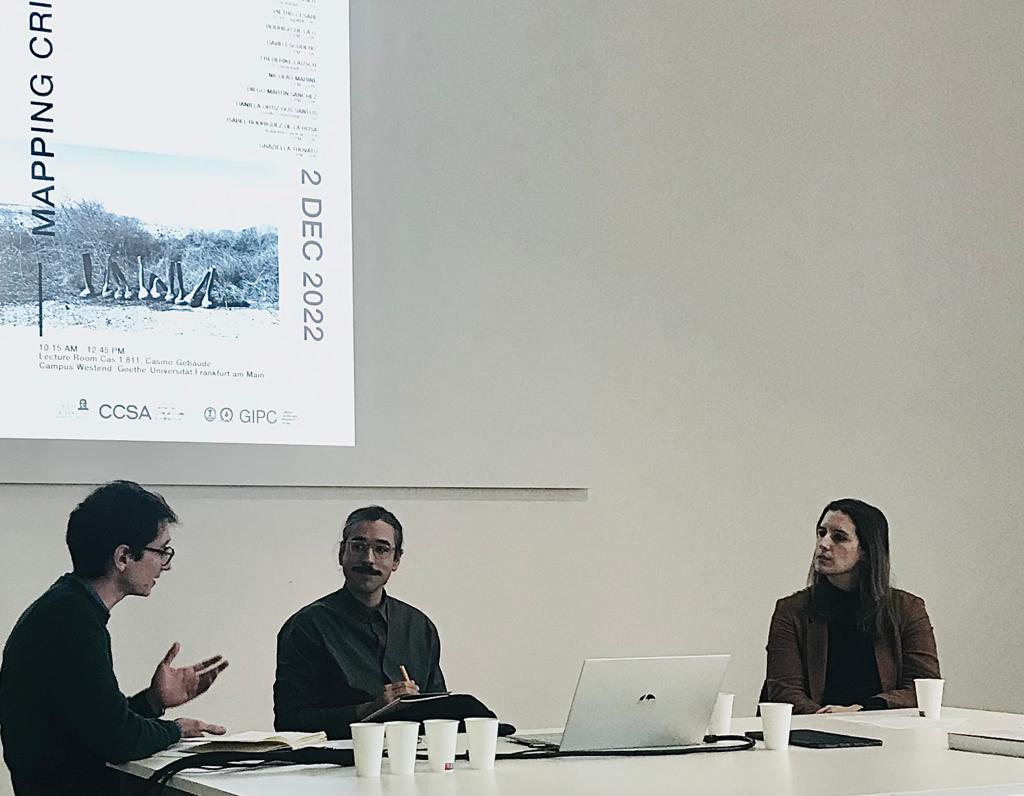
+Mapping Critical Heritage
Joint colloquium with the Center for Critical Studies in Architecture of the Goethe-Universität Frankfurt am Main, TU Damstadt and DAM Archives. The event is the starting point of a collaboration between the institutions involved in the International Joint Research Lab “Architecture Criticism and Heritiage”.
Frankfurt, 31.11.22 – 03.12.22
Coordination: Isabel Rodríguez de la Rosa (GIPC) y Daniela Ortiz Dos Santos (CCSA)
Patrimonio 20XX: desafíos de la conservación en la construcción de identidades
Seminar in collaboration with the Spanish Cultural Heritage Institute.
Madrid, 11.05.22 – 12.05.22
Management: Carmen Caro (IPCE) y David Escudero (UPM)
Geoinformación aplicada al patrimonio
MOOC (Massive Open Online Course). Miriadax, UPM
Management: Tomás Herrero.
Ensambles: Paisaje Contemporáneo y Práctica Patrimonial
Forum of 7 online sessions in the framework of the Research Network on Cultural Landscapes. Participation of 13 Spanish and 2 European universities, 1 public research organisation, 4 public administration entities, 2 cultural institutions and 5 companies.
Management of the Network: Francisco Arques / Scientific coordination: Rodrigo de la O
Bachelor's thesis (TFG) and Master's thesis (TFM)
+TFM. I. Iván Núñez Espinosa (2022) Paisaje Cultural agrosilvopastoril del Sistema Central: principios y medidas para la conservación de las redes de setos en la Comunidad de Madrid. Tutor: Nicolás Mariné y Cecilia Arnaiz.
TFM. Erika Mejía Zea (2021) Surcos entre Colegas: Significación de los paisajes cotidianos de la periferia de Madrid a través del cine español (1950-2000). Tutor: David Escudero.
TFM. I. Navas Nicolás. (2020) Climate change impact on European agricultural production. Dynamics of change. Tutor: María Fe Schmitz y Cecilia Arnaiz.
TFM. M. R. Pérez Regidor. (2020) Estudio a nivel radicular del arbolado caído por vuelco en los jardines de la Granja de San Ildefonso (Segovia). Tutor: Cristina Herrero
TFG. Eduardo de Nó Santos (2022). Ecologías productivas: Agricultura Urbana en la Región Metropolitana de Madrid. Tutor: Rodrigo de la O.
TFG. Beatriz Salido Fortuna (2021). Cuatro miradas sobre el Valle de los Caídos. Tutora: Concha Lapayese.
TFG. Yaiza Pozuelo Morillas (2020). Alternativas de procesado de un vuelo UAV del despoblado de Oreja (Toledo). Tutor: Serafín López-Cuervo
TFG. Roberto Zeferino Leandro (2020). Influencia de la vegetación sobre los servicios ecosistémicos de las ciudades: Revisión bibliográfica. Tutoras: C. Herrero y C. Arnaiz.
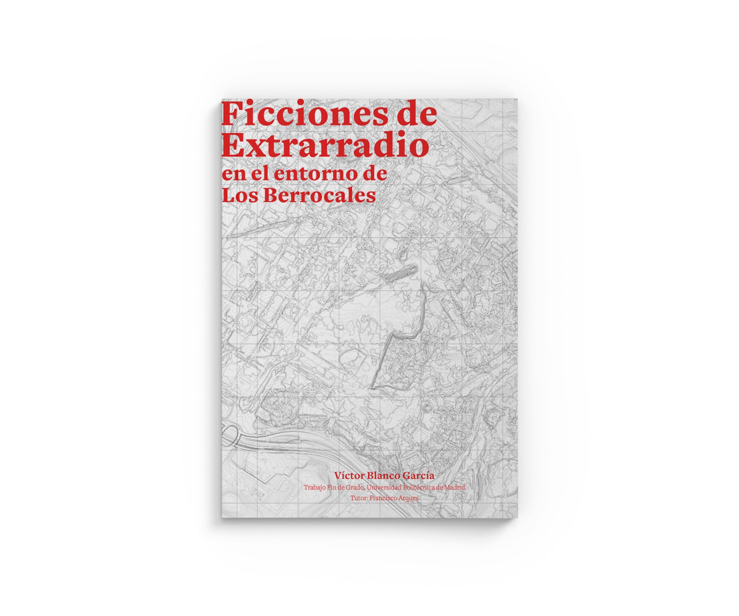
TFG. Blanco García, Víctor (2021). Ficciones de extrarradio en el entorno de Los Berrocales. Tutor: Francisco Arques Soler.
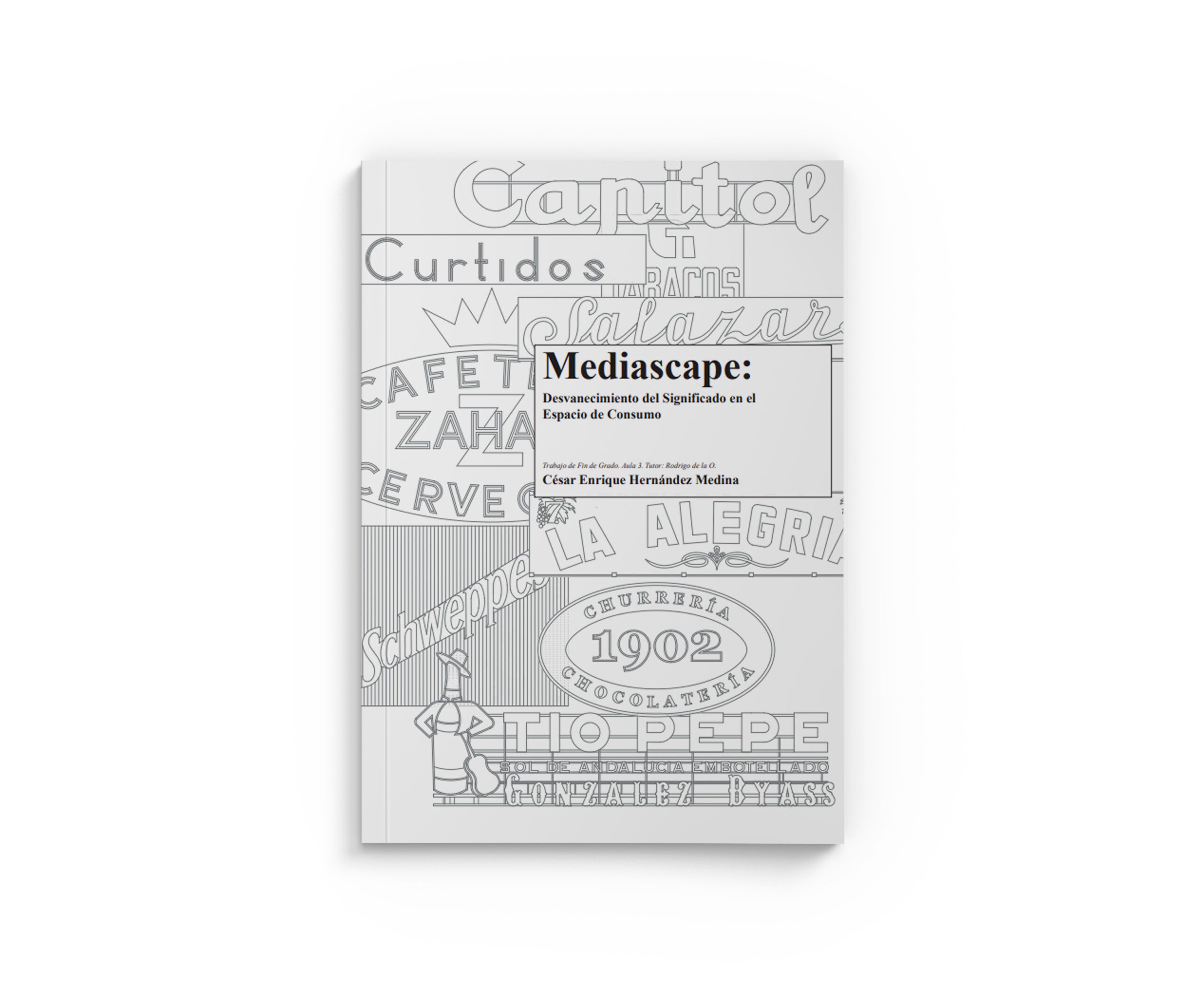
TFG. Cesar Enrique Hernández Medina (2021) Mediascape: Desvanecimiento del significado en el espacio de consumo. Aplicación al paisaje urbano del centro histórico de Madrid. Tutor: Rodrigo de la O.
TFG. Ricardo Tapias Moreno (2021) Bosques proyectados: La silvicultura como herramienta integral de diseño. Aplicación a la Sierra de Guadarrama. Tutor: Rodrigo de la O.
TFG. Alexandra Bazan Barrios (2021). Determinación de la severidad de incendios a partir de imágenes Sentinel 2. Tutora: Estibaliz Martinez Izquierdo.
TFG. David Muñoz Morón (2021). Aplicación de metodología BIM sobre patrimonio en la Iglesia de Nuestra Señora de la Oliva (Madrid). Tutores: Julián Aguirre y Serafín López-Cuervo.
TFG. Antonio Mendaña López (2021). Estudio Comparativo de precisiones entre topografía clásica y escáner láser. Tutor: Serafín López-Cuervo.
TFG. Alonso Castaño, Paloma (2021). Arquitectura y mito. Dioses y héroes en el jardín de los Austrias. Tutora: Carmen Toribio.
TFG. Egido Esteso, María José (2021). El paisaje acuático de la Casa de Campo. Estudio crítico de los elementos de agua del parque madrileño. Tutora: Carmen Toribio.
TFG. Arenillas de los Ríos, María (2021). Arquitectura High-Tech para plantas y aristócratas. Invernaderos Madrileños del siglo XIX. Tutora: Carmen Toribio.
TFG. Torres Carrero, Vicente (2021). Parques palimpsesto: Parque de La Almudena y Parque Villa Rosa cuarenta años después. Tutora: Carmen Toribio.
TFG. E. Fernández González (2021) Proyecto de acondicionamiento ambiental de la cola del embalse de Pedrezuela (Guadalix de la Sierra, Madrid). Tutora: Ana Belén Berrocal.
TFG. I. García Risco (2021) Análisis y propuestas de actuación para el arbolado del Parque Emperatriz María de Austria (distrito de Carabanchel, Madrid). Plan de rehabilitación de la Zona Central. Tutora: Alicia López Rodríguez.
TFG. L. Pablos Tanarro (2020) Revisión del proyecto: Restauración de “El Forestal” (1998). Propuesta de actuaciones para la recuperación de la cubierta arbórea. Villaviciosa de Odón (Madrid). Tutora: Alicia López Rodríguez.
TFG. Irene Fernández Gómez (2020). Eficacia de los Espacios Naturales Protegidos en la Conservación de los Sistemas Agrarios de Alto Valor Natural. Un caso de Estudio en la Comunidad de Madrid. Tutor: María Fe Schmitz y Cecilia Arnaiz
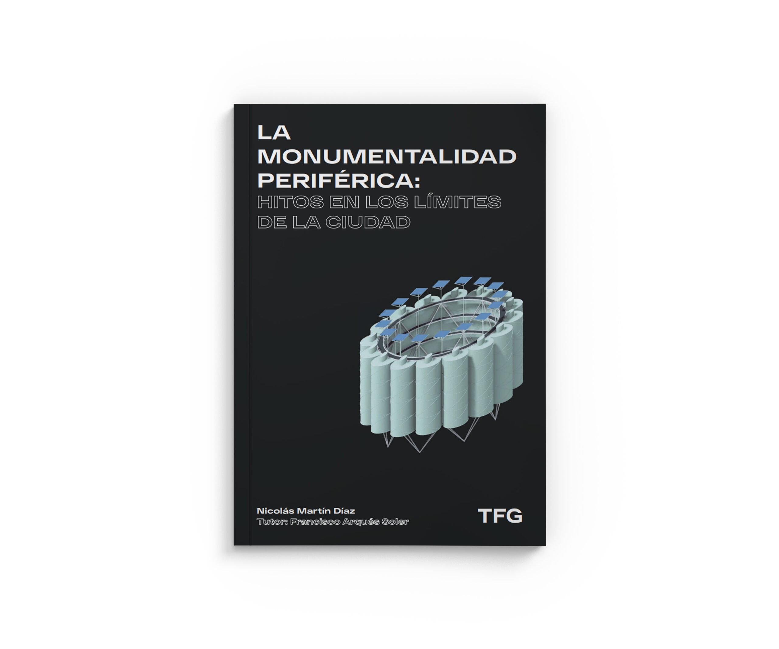
TFG. Martín Díaz, Nicolás (2020). La monumentalidad periférica: hitos en los límites de la ciudad. Tutor: Francisco Arques Soler.
TFG. Hernández Jerez, Guillermo (2020). Accidentes en el paisaje: desterritorialización de la arquitectura, construcción de nuevos territorios. Tutora: Concha Lapayese.
TFG. Gutiérrez Arribas, Guillermo (2020). MadrYZ: la interacción urbana de las generaciones Y y Z con Madrid. Tutora: Concha Lapayese.
TFG. Baatti Boulahia, Amina (2020). Interpretación del paisaje sonoro. Análisis de los umbrales acústicos. Tutora: Concha Lapayese.
TFG: Mohino Revuelta, Lucía (2020). El vapor en la ciudad. Irrupción del ferrocarril a través del arte. Tutora: Graziella Trovato.
Other results
+Articles and interventions on outreach and scientific culture:
- Herrero Jáuregui, C. (2021). ‘La burocracia para comprar dos ovejas que desbrozasen mi jardín’. El País. 16/11/202
- Herrero Jáuregui, C. (2021). A vivir que son dos días. Radio Periférica. ‘La oficina del campo y la mar’. Cadena SER.
- Díaz Pineda, F. (2021). Día del Medio Ambiente. La verdad desnuda. Capital Radio.
- C. Arnaiz (2021). “Turismo de naturaleza y ordenación sostenible del territorio”. Unidad de Cultura Científica de la Universidad Politécnica de Madrid (OTRI).
C. Herrero Jáuregui, M.F. Schmitz Gacría, S. Llorián González, M. Gómez Juaristi, B. Acosta Gallo, E. Andivia Muñoz, C. Arnaiz Schmitz, P. Sarmiento Mateos. Aprender divulgando: mejora del aprendizaje de conceptos y de la expresión oral y escrita mediante la divulgación científica. Memoria de resultados [Enlace]

Training activities
Workshops and seminars LABPA-CM
+Mapping Critical Heritage
Joint colloquium with the Center for Critical Studies in Architecture of the Goethe-Universität Frankfurt am Main, TU Damstadt and DAM Archives. The event is the starting point of a collaboration between the institutions involved in the International Joint Research Lab “Architecture Criticism and Heritage”.
Frankfurt, 31.11.22 – 03.12.22
Coordination: Isabel Rodríguez de la Rosa (GIPC) y Daniela Ortiz Dos Santos (CCSA)
Patrimonio 20XX: desafíos de la conservación en la construcción de identidades
Seminar in collaboration with the Spanish Cultural Heritage Institute.
Madrid, 11.05.22 – 12.05.22
Management: Carmen Caro (IPCE) y David Escudero (UPM)
Geoinformación aplicada al patrimonio
MOOC (Massive Open Online Course). Miriadax, UPM
Management: Tomás Herrero.
Ensambles: Paisaje Contemporáneo y Práctica Patrimonial
Forum of 7 online sessions in the framework of the Research Network on Cultural Landscapes. Participation of 13 Spanish and 2 European universities, 1 public research organisation, 4 public administration entities, 2 cultural institutions and 5 companies.
Management of the Network: Francisco Arques / Scientific coordination: Rodrigo de la O
Participation in official Master's studies
+The consortium groups offer courses in the following official master’s degree programmes:
Participation in own Master's degrees
+The consortium groups offer courses in the following Master’s degrees:
Participation in official bachelor's degrees
+The consortium groups offer courses in official degree programmes:
- UPM. Arquitectura: Taller ‘Acciones hbridas en el paisaje: entre arte y arquitectura’.
- UPM. Arquitectura: Trabajo Fin de Grado en temáticas de arquitectura de paisaje.
- UCM. Biología: Ecología.
- UCM. Biología: Trabajo Fin de Grado en temáticas de ecología del paisaje.
Internationalisation
+Via the Eurpean Council of Landscape Architecture Schools (ECLAS), it subscribes to the following training activities:
LVMP
The Landscape Visualization and Modeling Lab (LVMP) uses geomatics technology to investigate new methods of representation, mapping, modeling and visualization of large-scale environments for heritage and landscape conservation. To this end, LVMP relies on advanced models that relate and synthesize georeferenced information in visualization processes.
More information: Lab LVMP
News

Landscapes as Cultural Heritage: Contemporary Perspectives
Nicolas Marine, Cecilia Arnaiz-Schmitz, Rodrigo de la O and David Escudero edit a special issue of the journal Heritage, entitled ‘Landscapes as Cultural Heritage: Contemporary Perspectives’. Heritage is a journal in the first quartile (Q1) of the Scimago Journal Rank (SJR) for Conservation.
Over the past two decades, many countries have re-evaluated their national planning systems and landscape conservation policies to give them a heritage focus. During this same time, multiple ways of approaching landscape studies from a heritage perspective have emerged. This is both in a technological sense, which contemplates new data sources, virtual tools and innovative forms of dissemination, and in a conceptual sense, which includes various agents in the valuation processes or seeks the conservation of the landscape as a living cultural asset. Therefore, this Special Issue aims to reflect on contemporary approaches to landscape as heritage, paying special attention to innovative methods and positions.
Mapping Critical Heritage
Joint colloquium with the Center for Critical Studies in Architecture of the Goethe-Universität Frankfurt am Main, TU Damstadt and DAM Archives. The event is the starting point of a collaboration between the institutions involved in the International Joint Research Lab “Architecture Criticism and Heritiage”.
Frankfurt, 31.11.22 – 03.12.22
Coordination: Isabel Rodríguez de la Rosa (GIPC) y Daniela Ortiz Dos Santos (CCSA)

railTOland APP
The railTOland project, financed with European funds Erasmus + presents next Friday November 25, 2022 one of its most relevant products, a mobile application that identifies and interprets the landscapes traveled by the railroad between Porto and Vigo. The project, led by the Polytechnic University of Madrid, seeks to enhance the value of European landscapes, as common heritage and identity of their peoples, and in particular, those perceived from the railroad. The railroad in Europe was not only one of the most powerful catalysts in the process of European consolidation, but also allowed a rapid dispersion of culture and knowledge throughout the continent. The railroad creates landscape and also allows to perceive it from a privileged position, as can be seen in the Porto-Vigo pilot line.
The railTOland APP geo-locates the train and activates explanatory audios of the values and characteristics of the landscape that can be perceived and also of the landscape that lies beyond the traveler’s view. It also offers information on more than 30 points of interest, as well as a 3D model of several buildings of heritage value. The application is available in English, Spanish and Portuguese and has been developed by the Centro de Computação Gráfica of the Universidade do Minho, in collaboration with the other project partners, the International Union of Railways, Université Gustave Eiffel, Università Politecnica delle Marche, Renfe and Comboios do Portugal.
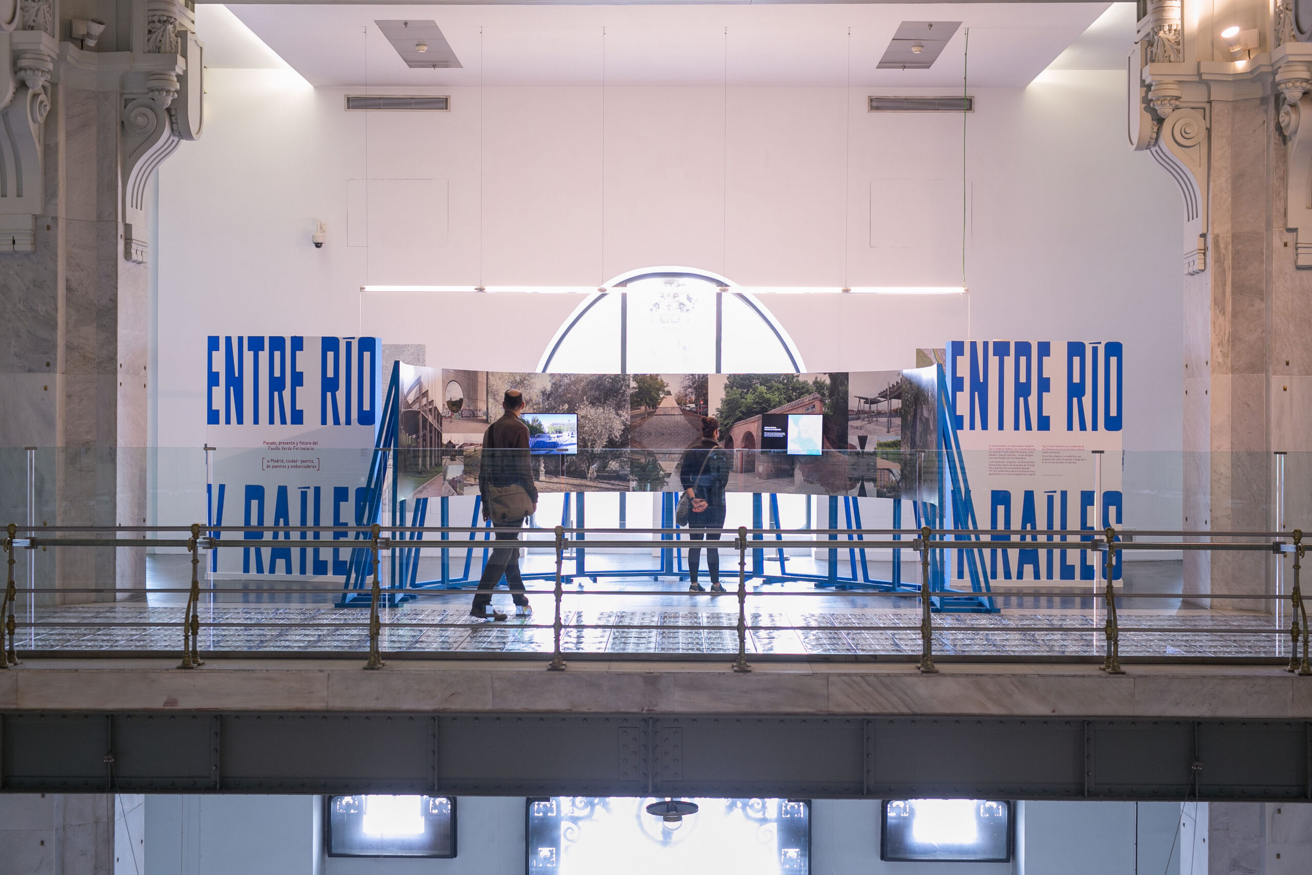
Entre río y raíles
Entre río y raíles is an invitation to reflect on the impact of industrialization and its decline in Madrid along the Green Railway Corridor, on the former river terraces of the Manzanares. Eight kilometers between Príncipe Pío and Atocha stations that today have the opportunity to become a natural expansion of Madrid Río, comprising nine neighborhoods: Acacias, Argüelles, Casa de Campo, Chopera, Palacio, Delicias, Imperial, Legazpi and Palos de Moguer. Through more than 1,000 images, plastic works from archives and documentary collections, audiovisual material and original urban photographs, it offers a journey from the effects of industrialization to the post-industrial era and the revision and natural reforestation of the area today.

EAAE - Towards a New European Bauhaus
The 2022 annual conference of the European Association for Architectural Education will take place as a hybrid event including keynote lectures, round tables and paper sessions. The conference is hosted by the ETSAM School of Architecture at the Universidad Politécnica de Madrid.
The Local Organizing Committee is formed by the members of the research group, Nicolás Marine and Rodrigo de la O.
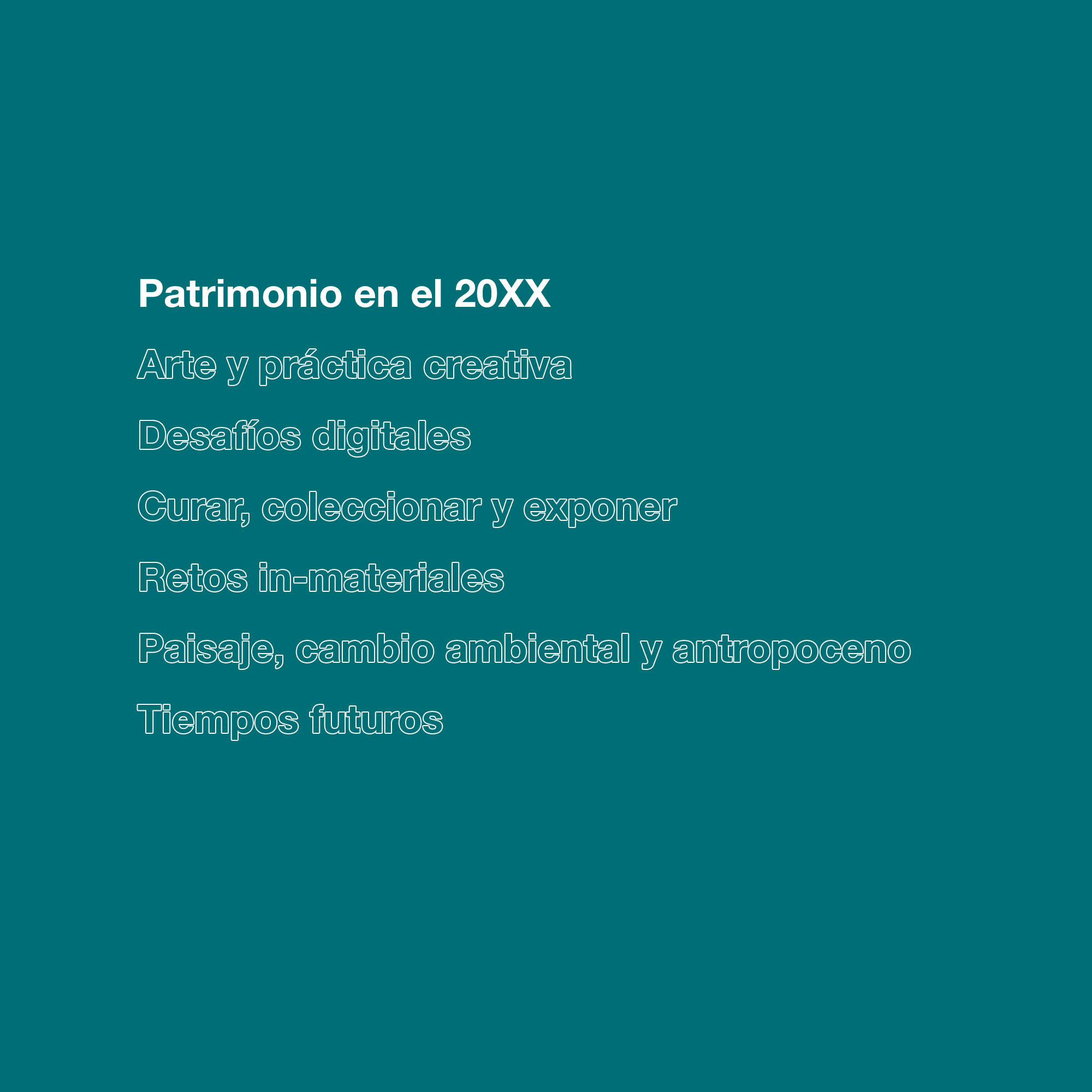
Patrimonio 20XX: desafíos de la conservación en la construcción de identidades
The seminar aims to show some emerging lines of critical heritage studies and generate a framework for discussion about them. From a transversal, multidisciplinary and pluralistic approach, it will combine theoretical and methodological lectures with interventions linked to professional practice. The lectures will explore topics that include, but are not limited to: the future of the concept of heritage in the 21st century; new forms of heritages; overcoming the past-future and nature-culture dialectics; the role of the digital and the new data landscape; the role of art, public space and the museum as social connectors; and the potential of critical studies at the national level.
ENSAMBLES: Paisaje contemporáneo y práctica patrimonial. Diálogos públicos online [16, 23, 30 October]
Twenty years have passed since the approval of the European Landscape Convention. This programme of seven dialogues reflects on the journey. Scientists, academics, engineers, architects and artists will confront research arguments on contemporary landscape and heritage practice in a context of critical redefinition of the relationship between humans and nature. With the organisation and participation of the three groups of our consortium.
Espacialidades del paisaje cultural
Lecture by Rodrigo de la O at the scientific meeting Conocer los paisajes de interés cultural del Instituto Andaluz del Patrimonio Histórico.Twenty years have passed since the approval of the European Landscape Convention. This programme of seven dialogues reflects on the journey. Scientists, academics, engineers, architects and artists will confront research arguments on contemporary landscape and heritage practice in a context of critical redefinition of the relationship between humans and nature. With the organisation and participation of the three groups of our consortium.

La burocracia para comprar dos ovejas que desbrozasen mi jardín
Article by Cristina Herrero in EL PAIS on the management of rural landscapes.
ENSAMBLES: Paisaje contemporáneo y práctica patrimonial. Diálogos públicos online [9, 16, 23, 30 April]
Twenty years have passed since the approval of the European Landscape Convention. This programme of seven dialogues reflects on the journey. Scientists, academics, engineers, architects and artists will confront research arguments on contemporary landscape and heritage practice in a context of critical redefinition of the relationship between humans and nature. With the organisation and participation of the three groups of our consortium.
La importancia del conocimiento de los límites de las vías pecuarias
Lecture by Tomás Herrero at the seminar Trashumancia y cultura pastoril en España: valores patrimoniales y perspectivas de futuro, organised by the Escuela de Patrimonio Histórico de Nájera of the Instituto de Patrimonio Cultural de España.